The start of the year was a bad one for residents of Kaiaua after being hit by a King Tide and Gail Force Winds combined which flooded the western side of the Firth of Thames, and then turned around and flooded the eastern side near Thames. Because emtel manages the Hauraki District Council GIS we were on task and on the job in the Civil Defence Emergency Management headquarters.
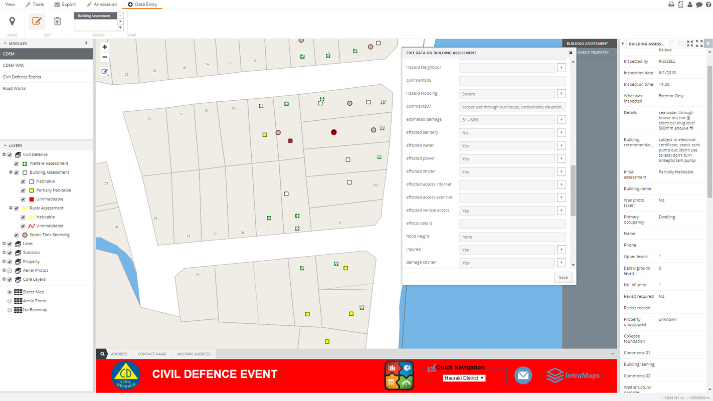
In previous months emtel had been working with Civil Defence staff at Hauraki District Council to build and extend on the existing GIS Civil Defence system with the aim of making relevant data available to all who needed it if such an event should occur. We came up with a number of live dashboards that graphed data as it was entered into the system live. This meant that all Civil Defence staff working during the event had immediate access to the data, to stats about the data, and to be informed of any major issues. Below are some screen shots of the GIS system and Dashboards in action.
Hauraki District Council GIS System – IntraMaps
LIVE DASHBOARD – Building Assessments

LIVE DASHBOARD – Welfare Assessments