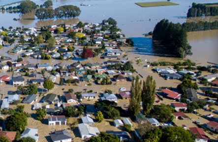
After the Cyclone Cook event Whakatane District Council headed straight back into managing the Edgecumbe Flooding event. The council declared the Recovery and were now looking to gather support from the Government, business’s, key people with Civil Defence knowledge. Once again the emtel hotline started flashing at the end of April, 12 days after the Cyclone. It was Whakatane requesting help with the set up of a centralised GIS that can manage the Recovery. Whakatane GIS Staff Member Casey Box has been given the task to lead the GIS project to ensure that GIS plays a pivotal role in supporting the Recovery process.
Ethan Hohneck has geared up and sent on his way back to Whakatane. Back in 2010 Ethan project managed and technically built the new WDC GIS System with Stephen O’Leary and his team. With this experience it meant Ethan would hit the ground running and roll with a system that he had a hand in building.
So far the Recovery process is going well. A fair bit of data cleaning and validating has been done. Maps are being built, and a centralised database created which deploys data to a central internal mapping system. Stage 2 of the project will see the centralised data utilised out in the field. For now things are going to plan. Keep up the good work.